Competencies
Scientific and practical activity

Development of software packages and data processing systems
Software processing of complex information flows includes:
– creation and maintenance of databases of specialized information which are a part of the integrated database of the Centre for the Rational Use of the Subsoil (information accumulation);– creation of integrated database spatial and information queries, which results in constantly updated maps on different fields of the Centre work and on their basis analytical tasks are solved (information consolidation).
These fields identify different branches in the common information area of the Centre but have much in common concerning solving methods. At the core of each field lie the software packages developed by the specialists of the subdivision. At the core of each solution lies the local database as the result of the activity or the means of the result obtainment automatization.
Database of geophysical well logging
The database “Geophysical well logging” contains results of digital recording, results of digital imaging of analog recording of the complex of geophysical well logging in different scales. Uploaded data are accompanied by the statement of the completeness of the complex of geophysical well logging.
The database “Geophysical well logging” contains information concerning more than 25.5 thousand well over 25 years (where more than 12.5 thousand of wells are prospecting and exploration).
After a thorough examination and spatial matching digital data are transferred to the database “Geophysical well logging” and are ready to be processed effectively.
Materials of the geophysical well logging are the most important information for the development and update of the geological model that is why creation and execution of database queries are a constant process.
Computer-based mapping
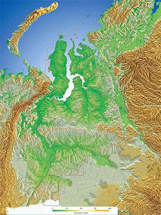
Means of geographical information system NextGis QGIS and additional in-house programs allow working with draw layers and tabulated information of the integrated base of the Centre. The result of a query is formed as a map. Each thematic field defines the content of such query, i.e. the content of the map. Procedures of the map layer updating, its installation and setup of standardized signs are automated.
Every year (or several times per year) along the territory of Khanty-Mansiysk Autonomous Okrug maps with scales 1:1 000 000, 1:500 000 on the following themes are updated:
- Geological exploration activities;
- Subsoil licensing;
- Nature management and production infrastructure;
- Structure maps;
- Seismic and drilling survey.
Web-mapping. Geoportal YURGA
Web service “Geoportal YUGRA” is developed by the Centre staff. Geoportal YUGRA has been active since 2014 in present form. The function of it is to provide an access to spatial data on the territory of the Okrug.
The main functional capabilities: map navigation, layers management (scale visibility, transparency), searching of objects by name, viewing of attribute information of the objects, using the base layers (as well as «Google maps»), length and square measurement on a map.
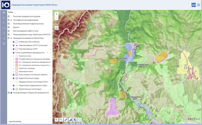
Published maps:
- Map of subsoil licensing within the Khanty-Mansiysk Autonomous Okrug-Yugra;
- Exploration works map.
- Map of nature management of the Khanty-Mansiysk Autonomous Okrug-Yugra.
- Map of natural resources using of the Khanty-Mansiysk Autonomous Okrug-Yugra.
- Tectonic map of the central part of the Western Siberian Plate under the editorship of V.I. Shpilman, N.I. Zmanovskiy, L.L. Podsosova, 1999.
- Geological zoning of oil fields map of the Western Siberian oil-and-gas province.
All necessary functions of the referral information access system to spatial data on the territory of the Okrug are realized in the Geoportal. Data are updated several times per year.
Head:
Goncharova Valentina Nikolaevna
☎ (3452)62-18-90
✉ gontchar@crru.ru
Scientific and practical activity


