Competencies
Scientific and practical activity

GEOLOGICAL MAPPING
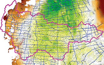
Specialists of the Department for mathematical modeling of geological objects developed and implemented original methods of mapping of geological surfaces, physical parameters taking into account diverse interconnected initial data and expert knowledge concerning physical nature of modeled objects. High performance of created methods allows preparing maps with high degree of detail of large territories, such as, for example, West-Siberian oil and gas province.
STRUCTURAL FRAMEWORK
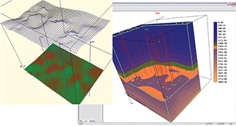
Developed by the Department computer technologies allowed to connect together geological information stored in the database of the Centre and develop on its basis the digital model of the sedimentary mantle along the territory of Khanty-Mansiysk Autonomous Okrug – Yugra and adjoining regions of Yamalo-Nenets Autonomous District, Tomsk and Tyumen regions. The digital structural framework is an arranged suite of contour maps of basic geological horizons and formations as well as thickness maps of relevant objects. Nowadays active work on connection of the regional model with detailed local studies takes place.
MORPHOLOGICAL ANALYSIS
The mechanism of the analysis of geological surfaces with identification of structural elements and their ranking according to geometrical characteristics (area, volume, amplitude, extension, etc.) was developed and implemented. These algorithms are actively used in the paleostructural analysis for the reconstruction of the history of the geological development of the sedimentary mantle.
BAZHENOV SUITE
Methods of geological mapping, developed in the Department, were actively used during works on the evaluation of the generative potential of sediment of Bazhenov suite. Using them it was possible to connect together the geological model of Bazhen with formation temperature fields and on this basis to prepare maps of geochemical parameters.
ESTIMATION OF RESERVES
Efficient algorithms of preparing maps of volumetric parameters and immediate estimation of reserves using volumetric procedure were implemented and continue to develop. The process of geometrization of the deposit was automated, i.e. region selection according to the saturation type as well as the assembling of volumetric areas. Easy patterns for the formation of boundaries of reserve categories were developed.
PROBABILISTIC MODELING
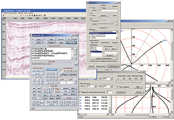
The way of the evaluation of accuracy of maps of different geological parameters, probability of structure existence and accuracy of estimation of reserves is developed. The software implementation of these methods and testing on the territory of fields of Khanty-Mansiysk Autonomous Okrug – Yugra.
Head:
Sidorov Andrey Andreevich
☎ (3452)62-18-77
✉ darth@crru.ru
Scientific and practical activity


